Ian Glendenning: Terrestrial Insights
Ian Glendenning provides a hiker’s insights, clear directions, technical details and aptly chosen quotations and poetic verse, bringing a broader perspective to his Terrestrial photography, and opening a window of opportunity for us all to venture out to discover firsthand the wonders of this part of Wales.
Cerrig Duon and Waen LLeuci
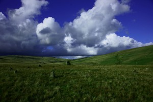
Ancient, long forgotten memories welcome visitors to the remote, lonely and haunting presence of the megalithic stone circle Cerrig Duon and its standing stone Maen Mawr. An enigma so beautifully summarized by Brian Griffiths in his book The Secret and the Sacred Beacons:
‘This is a place that will always be held sacred long after the reason for its foundation has been forgotten. It is a place that would come to be visited and used much later by a new generation of truth seekers. This is the continuity that will span the ages and the generations, manifesting itself in the many and varied ways that we choose to reach out to our gods. Cerrig Duon was one of these ways, and it was another step towards the infinite reality.’
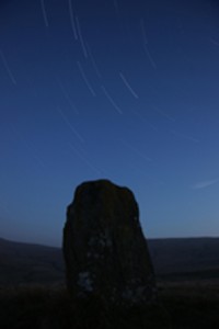
This photograph is of the standing stone Waen Lleuci in the Brecon Beacons, taken under ‘star trails’ and in the light of the full moon in April (19/4/11). Remarkably it is right by the spot I’ve set up my telescope over the years, in late night observing sessions, although I did not know of its existence until late last year. Being there at night meant I couldn’t see it! It is one of several in the area and over the same period I ventured out to find them, and ancient stone circles, attracted to their remoteness and tranquility. Waen Lleuci, is half a mile further N of the magical and beautiful stone circle, Cerrig Duon [Cerrig Duon, Ordnance Survey grid ref. SN 842 206]. I am fascinated by the prospect that they may have some astronomical significance too and hope to research this over the coming months.
The ‘constellation’ being ‘trailed’ in the image is the Plough and the photograph is made using a special technique of combining 121 separate 30 s exposures, all in the natural light of the one-day-past full moon. Photograph taken by Ian and Alex Glendenning. Many thanks Alexander for the skill and vision in creating the image.
Abandoned stones which I become interested in invite me to enter into their life’s purpose. It is my task to define and make visible the intent of their being. – Isamu Noguchi, The Isamu Noguchi Garden Museum
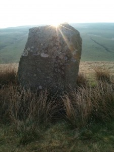
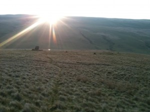
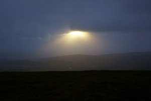
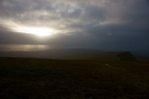
The two shots Cerrig Duon at Sunrise and Waen Lleuci at Sunrise were both taken on Saturday, 23 April 2011. Perhaps I should not reveal this but they were both taken with my camera phone and a modest 3 MP one at that! It rather debunks and demystifies having the need for expensive camera equipment.
With so many people carrying a mobile it means we can all be photographers at any time. And the best go all the way up to 10 MP and with HD video! An excellent level of quality.
The secret of a special photograph – is simply to be there!
[Cerrig Duon can be found on the ‘Old Trecastell Road’ off the A4067 Swansea to Brecon Road at Ordnance Survey Map ref SN 852 206. It is not visible as you come up to it and you need to cross a stream to reach it.]
Henrhyd Waterfall
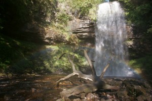
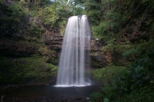
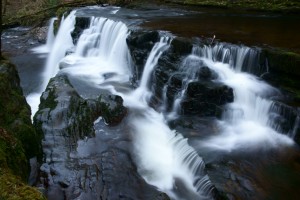
At over 90 feet (28 m) Sgwd Henrhyd is the highest waterfall in South Wales. It is a magical experience to visit the falls and especially awesome when frozen or after heavy rain or when lit by the sun with the spray threaded by a rainbow. At such times it is as likely to be frequented by film crews from London as local visitors. The falls are easy to reach and one can go behind the cascading water for an exhilarating view and in all probability an invigorating shower!
Photographs:
Henrhyd Waterfall With Rainbow taken 10/9/11: camera settings; 1/60 s, f/6.3, ISO 200.
Henrhyd Waterfall taken 10/9/11: camera mounted on a tripod, settings 1 s, f/20, ISO 100.
[Henrhyd Waterfall: just outside the village of Coelbren on the Nant Llech river in South Wales. Ordnance Survey Map grid ref SN 854122. Post code district SA10 9PF. Close car park, easy but steep path to the falls. Walkways are wet and surrounded by rocks so care is needed if one goes right up to or behind the falls. Other river walks to explore in the area too.]
Cribarth
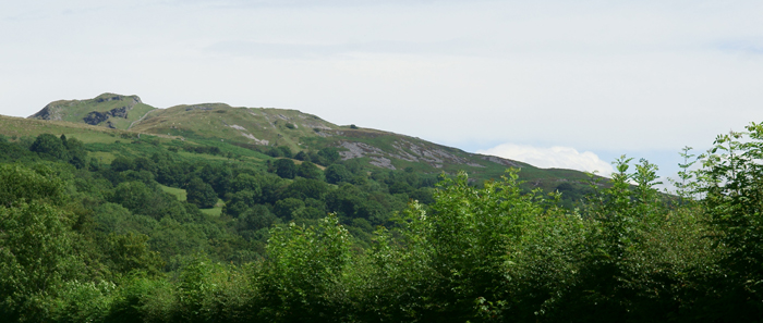
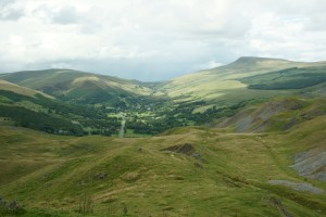
Right by Abercraf is a walk straight up to The Sleeping Giant, over Cribarth, by old quarries, cairns and beyond to the mysterious standing stones Saith Maen. A desolate, almost lunar landscape at times with views from the top of Craig-Y-Nos Castle and Country Park and the beauty of the mountainous Brecon Beacons beyond.
Photographs: View from Cribarth: of Fan-Gihirych (DSC02035) taken 6/8/11, camera settings: 1/160 s, f/10, ISO 100. View from Cribarth: Glacial Valley by Craig-Y-Nos (DSC02046) taken 6/8/11, settings: 1/125 s, f/11, ISO 200.
[Cribarth, with the profile of The Sleeping Giant, can be reached from School Road in Abercraf past the (now defunct) Maes-Y-Gwernen hotel SA9 1XD, a public footpath at the top of the road leads directly onto Cribarth, Ordnance Map ref SN 828 142. The walk is a continuous climb of a mile or so and once at the top there are vertical cliff like formations here and there, so care is needed.]
Carreg Cennen Castle
Y Mynydd Du (The Black Mountain) is a wild and remote place, being the most westerly region of the Beacon Beacons National Park and is officially classified as a wilderness. Anyone visiting will see why. I can do no better than quote Brian Griffiths from his lovely book The Secret and Sacred Beacons, as it perfectly sums up the deserted beauty:
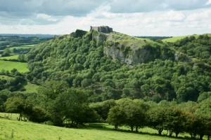
‘Anyone taking the time to seek out the haunted and remote should explore this mountain where they will find timeworn remains that still guard the high places. Roam these hills and you will find Castell Carreg Cennen, a beautiful castle that must rank as one of the most haunting and evocative ruins in the whole of Wales. Sitting atop a 300 foot (91m) sheer limestone rock wall in a seemingly impregnable defensive position, its situation within this ancient wilderness imbues it with a magic and mystique evocative of some ancient fable.’
This is a fairy-tale castle but not for the faint hearted. There are precipitous drops and a secret passageway that leads to an underground cavern and cave system that is lightless, slippery and quite dangerous (take a torch!) Overland there are two walks around the castle, the longer of which is 7.5 km, that whilst strenuous, rewards the traveller with panoramas of some of the most spectacular castle views anywhere in Britain.
Photograph taken 14/8/11; settings on f/11, 1/100 s, ISO 200 with a Sony Alpha 900 digital camera and a Carl Zeiss Vario-Sonnar lens.
[Carreg Cennen Castle: location close to Llandeilo, S Wales. Postcode SA19 6UA, Ordnance Survey (Map 159) grid ref: SN 668 191. Entry to the castle is £4 per adult, reductions for families and for children, who will love the castle but will need supervision, torches for the cavern can be hired or simply take your own. The walks of course are free, so is the car parking. For some more information www.castlewales.com/carreg.html]
Sgwd Einion Gam
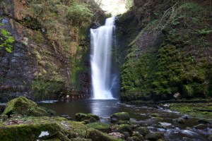
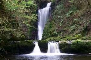
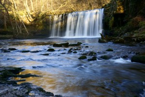
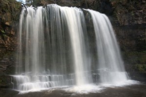
These two photographs are dedicated to Harry as Sgwd Einion Gam is one of his favourite waterfalls and it was Harry too who brought it to my attention, describing in enticing detail ‘its majesty’. Also known as the Forbidden Waterfall, due to the difficult to reach location, it is one of the highest waterfalls in South Wales and sided by a tremendous sheer cliff face in a beautiful natural ampitheatre.
Reaching the waterfall: A good day out can be had by taking the walk from The Angel, Pont Nêdd Fechan (near Glynneath) to the Lady Falls, Sgwd Gwladus, – in itself a lovely waterfall. At the top of this waterfall is the one time Rocking Stone – regretfully ‘vanalized’ by a group of workmen who tipped it over! Reaching Einion Gam (Ordnance Survey ref. SN 891 093) is not too difficult from here, but you must be prepared to cross the Pyrddin river four times, so wellington boots are recommended! For the second of the two photographs I needed to enter the ‘ampitheatre’ which at first I didn’t think was possible as it is protected by rock walls to the left and right of the waterfall pool entrance. However on the right side, I found, by taking a ‘leg-up’ on a protruding root, I was able to traverse a track round that took me directly into breathtaking magnificence and solitude.
The falls can also be reached from a forestry road off the A 4109 intervalley road between Glynneath and Banwen. Again crossing the river four times leads to the top of the falls. Although it must be stressed that it is quite dangerous at the top. As I can attest when nearly hurled from it – as a tree I was holding onto turned out to be rotten and snapped, not only robbing me of support but also doing its best to push me over with its weight!
DSC02176 Einion Gam camera settings: f/20, 1 s, ISO 100
DSC02179 Einion Amphitheatre camera settings: f/13, 1 s, ISO 100
Both taken 15/10/11 and both with the camera mounted on a tripod.
Lady Falls
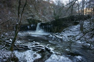
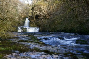
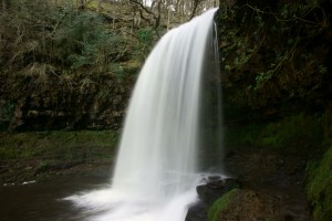
This photograph of Sgwd Gwladus – Lady Falls was taken 5th December 2010 after a very cold spell. I regret not going again as the cold spell was prolonged and the waterfall froze further. However I do have a photograph from 1985 when the temperatures were continuously at -20ºC. The waterfall froze from top to bottom as a pillar of ice, with the river running through the centre. It was a wonder to behold! In fact I had not long since moved to Banwen in 1984 when there was one of the worse droughts in recent years and an earthquake rocked the farmhouse Cwm Nant Hîr I was living in at the time! And then this, the following winter, was one of the coldest on record. I was beginning to wonder what else this place had in store. And here I found an untrammelled beauty.
The falls can be reached by a 1 mile walk starting at The Angel pub (SA11 5NR) in Pont Nêdd Fechan (near Glynneath), South Wales. Some further details are given with the Einion Gam photographs.
Foel Darw
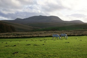
Around the Usk Reservoir (near Trecastle, Sennybridge) there are several standing stones and stone circles. On the south side of the Reservoir there are stone circles and a cairn (at SN 820 258) that are really remote and isolated and I thought they might be best reached by horses. However, having no horse, I planned a route through the Mynydd Wysg forestry and then up Foel Darw and down across the valley and the Nant Tarw, the stone circles are the other side of this stream. Before, on my way there, when I emerged from the forestry there was this field of white horses, shining in the low autumn sunlight, as I walked through on my climb to the top of Foel Darw.
In my whole trip I did not see one other person, only the horses. Just to the east is the Blaenau-uchaf Stone with a bridleway leading to the stone circles and just to the west is the site of a Roman camp at Arosfa Garreg Iwyd. To the north is the picturesque Usk Reservoir with a lovely walk all the way around it and the Physicians Well hidden deep within the forestry, to the north of the Reservoir, famously associated with the Physicians of Myddfai; Myddfai itself being a little further to the west.
The brilliant moon shines splendid in the night;
One may hear the house cricket singing on the east wall …
The Jade Scales speak of the beginnings of winter,
Scattering a million stars across the sky!
Penwyllt
Cave of the Black Spring
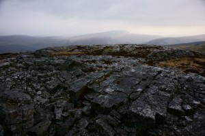
I had heard of the mysterious standing stones Saith Maen and determined to find them in early spring. I travelled to Penwyllt, in the Upper Swansea Valley, as I had found a ‘Saith Maen’ close on the Ordnance Survey map. I never found the stones that afternoon as Saith Maen by coincidence is the name also of some craggy slopes in this region! Perhaps fate had led me here anyway as I took a walk from the Penwyllt quarries, where I had once done some astronomical observing. It is now a National Nature Reserve and home of Ogof Ffynnon Ddu (Cave of the Black Spring). My walk continued from the old railway station, along the old railway track going south past the Caving and Mountain Rescue Post. Not finding the standing stones, the irony was not lost on me that I was surrounded by hundreds of huge boulders as I crossed the ever more rock strewn landscape of Carreg-Lwyd. I had thought it lunar desolate when I was at Cribarth (see above in Terrestrial), but this really was like walking on the Moon! I made for the highest outcrop, Carreg Cadno, and by this time I was walking a pavement of rock with the sky as roof.
I am very fortunate to live so close to this area of outstanding beauty and with so much of interest. On the Penwyllt side of the A4067, there is Craig-y-Nos Castle & Country Park (SA9 1GL). Carreg-Lwyd itself is a mile to the east of the Park at SN 864 152. On the other side of the road are the Dan-yr-Ogof Showcaves, the largest system of caves in western Europe. It is on this side of the road that I later found the standing stones Saith Maen. They are actually not far in distance from Craig-y-Nos and are also close to Cribarth. I would estimate their grid reference as SN 831 156. There really is something for everybody; tourists, ramblers, spiritual seekers, stargazers and definitely a mecca for photographers! There is so much to enjoy and explore in this area.
Photograph DSC01612a Penwyllt: Carreg Cadno taken 12/3/11.
Y Pigwn
Just north of the picturesque Usk Reservoir lie an isolated and remote pair of stone circles. They can be reached from Trecastle by following the Roman Road until coming to the remains of a Roman Camp on the crest of the hill Y Pigwn. The stone circles are just to the east of the Camp at map ref SN 833 311. The photograph shows a Half Moon over one of the pair. By coincidence when I visited Foel Darw (see above) there was once again a Half Moon in the sky over the stone circles there with it being one month later. On my excursions to these stone circles I found a serene tranquility in these places and it was lovely to witness too the rhythms and cycles of nature lending a presence of time as well as space.
Photograph DSC01219 Half Moon Over Y Pigwn taken 16/10/10.
Sunset Boulevard
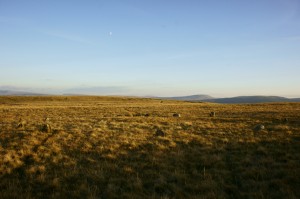
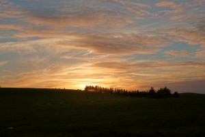
Not all my excursions immediately found the intended destination. When searching for Feol Darw (see above) I had tried alternative routes the previous week, that although unsuccessful in locating the stone circles, still gave lovely walks and viewing opportunities. Most of the photographs in this Terrestrial collection were taken in the Brecon Beacons National Park and it seems the extraordinary is always around. This one is of a simple pastoral scene of sheep grazing, that I did not think much of at the time, only later did I realize just how dramatic the sky was with the clouds and setting sun. It is easy to lose track of the horizon when living in an urban or even a rural setting as we are so often surrounded by houses and trees. But from a location like the Beacons the horizon can be low, unfettered, and the sky can have a clarity and translucence that is perhaps hidden or lost from our normal dwelling abodes.
Photograph Sunset South of the Usk Reservoir taken 6/10/10.
Twin Lakes for Twin Mountains
It is a source of wonder to me that the little lay-by in which I have set up my telescope for late night stargazing has turned out to be a veritable epicentre of magical attraction. To the east there is Waen Lleuci, to the south Cerrig Duon and to the west I find that watery expanses in the mountains are then calling.
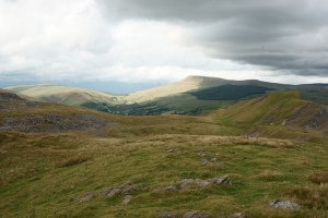
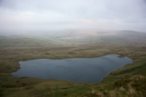
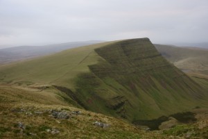
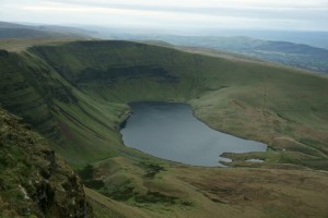
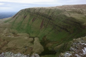
Over two December Saturdays I ventured over to the lakes of Llyn y Fan Fawr and Llyn y Fan Fach, climbing the mountains between them: Fan Brycheiniog (‘Brycheiniog Bannau’ on my old Ordnance Survey map: SN 825 218), at over 800 m one of the highest peaks in the Brecon Beacons, and Fan Foel (Bannau Sir Gaer) at over 750 m not far behind. Twin lakes for twin mountains: and all absolutely enchanting. It was a revelation at the top after the rocky landscapes of Cribarth and Penwyllt, I was expecting much the same but here were verdant grasslands stretching over as far as the eye could see to the mountains beyond – and this in December. The following six photographs were all taken 3/12/11 on my first excursion.
Photographs: Llyn y Fan Fawr from Fan Brycheiniog : 1/80 s, f/6.3, ISO 200
Fan Foel from Fan Brycheiniog : 1/60 s, f/5.6, ISO 200. With the lake Llyn y Fan Fach just visible to its right.
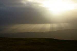
It was unbelievable up there with the exhilarating freedom, the light, shade and colours. I was on high – literally. The following three photographs are all up at the top of Bannau Brycheiniog.
The irony is that at the start of the trip I nearly turned back as there was a lot of cloud around and I didn’t think the light good for photography!
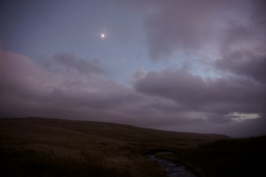
One of the problems in going out at this time of the year (apart from the cold) is that it gets dark so early. In fact middle December has the earliest sunsets of the year, even earlier than on the shortest day, the Winter Solstice. For an explanation for this you’ll have to come to one of my astro classes! This meant that by 5 o’ck I was coming back in total darkness. Probably not the best idea as apparently there are a lot of sink holes around. However digital cameras have very sensitive eyes as it captured this scene at this time. And yet again I continue my love affair with a Half Moon in the sky!
The second of my trips was 10/12/11 and with it being colder and darker even than the previous week I had to hare up Fan Brycheiniog and across to Fan Foel by 3:30 whilst it was still light but I was rewarded by these superb and dramatic views. It was also an auspicious date to go out as there was a total eclipse of the Moon that night. I was hoping to take a photograph of an eclipsed Full Moon over Cerrig Duon but alas from Britain by the time the Moon had risen the total eclipse was over, and anyway it was all obscured by clouds! Still it was lovely to be back at the stones when all these things were happening. Next chance for this will be in 2014!
In October 2010 I went to Myddfai where there is a fascinating history of healers and physicians and, although quite a distance, there is a link with the Physicians Well up at the Usk Reservoir. This was by Myddfai Church:
‘Myddfai is celebrated for its fair maidens;
“There is white snow on the mountain’s brow,
and greenwood on the Ferdre,
Young birch so good in Cwm-Brân Wood,
and lovely girls in Myddfe.”
This tradition may have derived from the legend of the Physicians of Myddfai which tells the tale of a beautiful fairy maiden who rose from the waters of Llyn y Fan Fach. This lake is found in the shadow of the Black Mountain.’
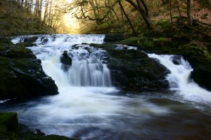
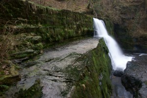
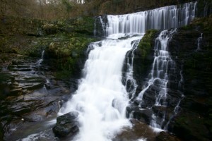
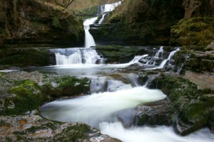
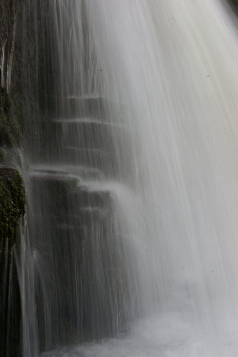
WATERFALL COUNTRY
THE ELIDIR TRAIL
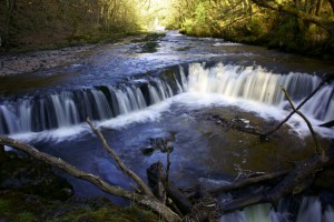
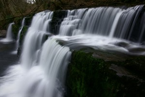
Just outside the village of Pont Nedd Fêchan (near Glynneath), past the Angel and Dinas Rock pubs, a left road up the hill goes towards Ystradfellte. After about a mile and a half, a backroad on the left takes you to Pont Melin-Fâch (SN 907 105) where there is large car park and picnic area in the woods by the River Neath. Enough in itself for a lovely afternoon but from here you can take (to the right) The Elidir Trail. In just over a one mile walk, in glorious countryside, you can pass the wonders of Sgwd Ddwli Uchaf (the Upper Gushing Waterfalls), Sgwd Ddwli Isaf (the Lower Gushing Falls), Sgwd y Bedd (Horseshoe Falls) and on to Sgwd Gwladys (Lady Falls). The track is well maintained and nicely level, so very suitable for a family outing. All the falls can be walked up to, but as usual care needs to be taken as paths are slippery, inclines here and there can be steep and, of course, there are rocks all around.
THE FOUR WATERFALLS WALK
The Four Waterfalls Walk is linked to yet further natural wonders in this magical area. To the north it can be taken to the famous caves at Porth yr Ogof; to the south it can be extended to the equally famous Craig y Ddinas (Dinas Rock). There are also large car parks in both these locations, so it is possible to just visit them without any trekking!
Inscription
Oh useless words that still cannot record
The shading of a pearly-fingered dawn,
Enchanted quiet of a woodland trail,
Wind-drifted odor of fern-hidden flowers
Or moonlit stillness ’round a northern lake,
The futile memory of an oboe’s soft
Complaint, too haunting in its loveliness!
These things escape us like a faw at dusk.
They are not trapped in sounds of any words
In shrewd arrangement on a printed page.
Creation is too much for us – the tower
Of mountain grandeur, caped in storms of snow,
The multi-voiced and restless watery waste
That calls all night-long vaguely to the moon,
And heaven’s unmeasured space sown thin with stars.
Yet all these things lie hidden in the mind
Of man; and in his heart, still less expressed,
There broods unendingly the cosmic love.
– Cary Sterling Clifton
WINDOW ONTO WALES…WINDOW ONTO WALES…WINDOW ONTO WALES
Hosted by Wendrich artHouse

